


About SGS
The Saudi Geological Survey (SGS) is responsible for all specialized earth science works in the Kingdom of Saudi Arabia, from the basic works on geologic mapping to the conduct of applied geoscientific studies, especially on mineral and groundwater explorations and the development of mineral resources, including the provisions of investment opportunities in the field of mining. According to the SGS Statute, the SGS administers the priority programs of the government that are focused on hydrogeological, environmental, and engineering geology studies and the monitoring of geologic hazards, seismic and volcanic activities. The SGS serves as the main source of scientific information in Saudi Arabia in the form of technical reports, geologic maps, mineral resources, and other relevant geologic data about the Kingdom.
Vision
Global leader in earth science research, conducting surveys on natural resources, and monitoring geological activities to safe society, and facilitate the Kingdom's efficient utilization of its natural resources.

Mission
To benefit from our expertise, partnerships, and modern technologies to achieve a distinct value as a global reference in earth sciences for the public and private sectors in the Kingdom by providing geological maps and data with scientific objective visions and developing the next generations of talents.
Values
Global leader in earth science research, conducting surveys on natural resources, and monitoring geological activities to safe society, and facilitate the Kingdom's efficient utilization of its natural resources.
SGS Strategy
In order to translate this future vision into a reality, the SGS is looking forward to adopt advanced technologies for aerial surveying to better serve its surveying and exploration programs as well as its environmental geology programs. This can be achieved through partnership and collaboration with leading international institutions in these technological areas.
Services

E-shop
Selling SGS's products, including reports, books, and geological maps

Insulation Material Study
Request for approval of insulation materials used in projects
Technical study
Request for review and approval of a technical study for a project

NGD
Reliable national geological and topographic data repository for the whole kingdom of Saudi Arabia

Rawasi
A reliable platform for national geological hazards in the Kingdom of Saudi Arabia that provides data on geological hazards.
SGS Latest
Show All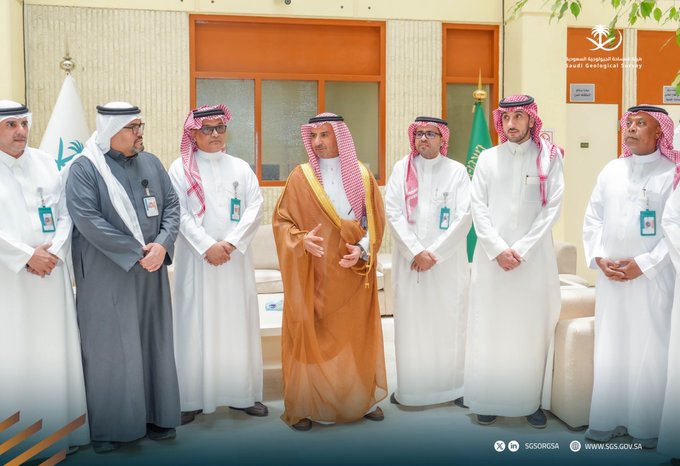
08/December/2024
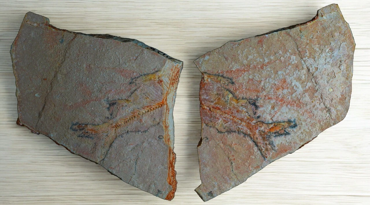
New Fossil Discovery from the Early Eocene in Northern Saudi Arabia
The Saudi Geological Survey revealed a new discovery of early Eocene marine vertebrate fossils in the Northern Borders Region of Saudi Arabia. The new finds include imprints and internal molds of bony fish species. Articulated fossils of teleost fishes in this the new fossil locality include Siluriformes and possibly Cypriniformes, with most specimens ranging in length between a few cm and 15 cm. the new discovery should provide detailed information on the paleogeography and Paleoecology of the environment of the Early Eocene marine communities in the Tethyan Sea.
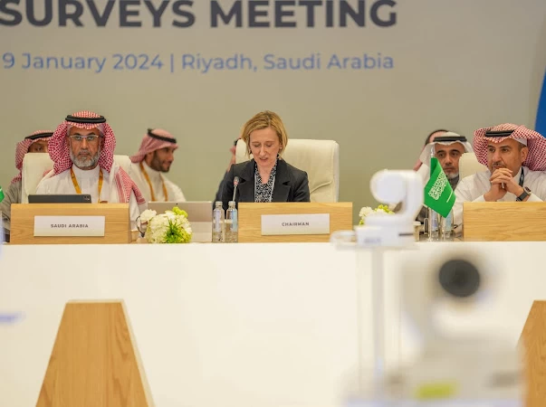
10/July/2024
Saudi Arabia Hosts First International Geological Surveys Meeting, Promoting Sustainable Development and Collaboration
Riyadh, Saudi Arabia - In a milestone event, Saudi Arabia played host to the inaugural international meeting of geological surveys, welcoming numerous countries from across the globe. The meeting, chaired by His Excellency Mr. Khalid bin Saleh Al-Mudaifer, Deputy Minister for Mining Affairs, aimed to facilitate international cooperation and knowledge exchange, fostering sustainable development in the region. Coinciding with the third edition of the Future Mining Forum, the gathering delved into various topics and advancements within the mining and minerals sector.
The meeting commenced with an opening speech by His Excellency the Deputy Minister, who underscored the significance of integrating the geological perspective into the pursuit of a sustainable future. Mr. Abdullah Al-Shamrani, Deputy Chairman of the International Meeting of Geological Surveys, followed with a warm welcome to the participating delegations, expressing gratitude to the organizers of the Future Minerals Forum for hosting this prestigious event. He acknowledged the challenges faced by geological surveys worldwide, as highlighted in the ministerial roundtable, and emphasized the importance of exchanging ideas concerning Saudi Arabia's geological wealth and its strategic approach to surveying, exploration, extraction, and responsible mineral utilization. Al-Shamrani further emphasized the Kingdom's geological landscapes as a hidden treasure trove of vital minerals.
Throughout the meeting, attendees engaged in constructive discussions on a range of topics, including the geological potential of emerging mining regions in Africa, West Asia, and Central Asia. The challenges encountered in survey activities globally were also explored. Additionally, the participants focused on leveraging international experiences to bolster regional capacities, bridge the geological survey gap, promote mineral exploration, prioritize survey areas, and identify funding sources. The meeting shed light on the significance of developing geological databases and ensuring accessibility in emerging mining regions, facilitating increased mining investments and public access to digital geological survey data. Furthermore, attention was given to updating geological data management systems and enhancing geological survey capacities at individual, operational, and systemic levels, ultimately supporting exploration development through skill enhancement, system improvement, efficient land access, data management systems, and funding source identification. These efforts aimed to foster a collaborative environment for geological surveys.
The meeting concluded with several key recommendations, including the establishment of a permanent coordination and collaboration mechanism among geological surveys in the region. Furthermore, the participants emphasized the need to enhance cooperation in geological research and development, as well as the importance of updating digital geological survey data and making it readily available to relevant stakeholders worldwide.
Last Update Date : 08/March/2026